Archeaological Surveying

ClosePlease login

No account yet? Register

02 Nov 2023

Drones and Archaeology

How drones are changing the way archaeologists explore and document ancient sites

Archaeology, the study of human history and prehistory through the excavation of artifacts, structures, and other physical remains, has experienced a paradigm shift with the advent of drones. These small but mighty flying machines have revolutionized the way archaeologists explore and document ancient sites, allowing them to capture aerial footage and photographs with unprecedented clarity and detail. In this post, we shall embark on a journey of discovery, delving into the advantages and drawbacks of using drones in archaeological research, marveling at their wondrous applications, and pondering the ethical implications of this emerging technology.

Uses and benefits of archaeological surveying with drones

Archaeologists now have a powerful tool at their disposal: drones. Read on to discover the benefits of using these flying machines in archaeological research.
Aerial Photography and Videography
Drones can capture detailed aerial photographs and videos of archaeological sites, creating maps, 3D models, and virtual reconstructions of the site facilitating the process of geospatial mapping.
LiDAR Mapping
LiDAR technology mounted on drones can create highly accurate and detailed 3D maps of archaeological sites, revealing subtle features and structures that may not be visible from the ground.
Thermal Imaging
Drones equipped with thermal cameras can detect temperature differences in the ground, indicating the presence of buried structures or features.
Magnetometry and Ground-penetrating Radar
Drones can carry equipment such as magnetometers and ground-penetrating radar, which can detect the presence of buried structures and artifacts.
Site Monitoring
Drones can monitor archaeological site conditions over time, providing valuable data for conservation and management.
Excavation and Analysis
Drones can create high-resolution 3D models of excavation sites, allowing researchers to study them in greater detail and from different angles.
Remote Sensing
Drones can conduct remote sensing surveys of archaeological sites, detecting buried structures and features not visible to the naked eye.

Why is the use of drones beneficial to the archaeologists?

High Precision in Inaccessible Areas

Drones can document and record discoveries with high precision and survey previously inaccessible areas, enabling remote sensing and mapping.

Precise Planning

Drones assist archaeologists in planning future digs by providing an aerial perspective of the area under investigation, allowing them to assess the damage caused by natural disasters or human activity and assist in necessary restoration or preservation work.

Prevent Illegal Excavations

Drones monitor and protect archaeological sites by detecting unauthorized excavation activities and alerting appropriate authorities.

Assist in Digital Reconstruction

Drones can aid in the digital reconstruction of ancient sites, creating accurate digital reconstructions of ancient structures and landscapes.

Monitor and Protect Archaeological Sites

By performing site exploration, drones can detect changes or damage to the site caused by natural erosion, human activities, or climate change and provide real-time surveillance and evidence collection for law enforcement.

Non-invasive Method of Exploration

Drones can create detailed maps and models of sites without disturbing the underlying soil and sediment layers, preserving the site's integrity and minimizing the risk of losing valuable historical information.

Some less common benefits
Drones equipped with sensors such as lidar or multispectral cameras can provide data on archaeological sites’ geophysical and environmental characteristics. The information extracted can be used to map the soil composition, identify buried structures, and even locate previously unknown archaeological sites.
Moreover, they can also offer opportunities for public engagement and education. Interactive 3D modeling and virtual reality experiences of archaeological sites can provide the public with an immersive and accessible way of learning about the past. As a result, both archaeologists and the public can assist in promoting cultural heritage tourism, raise awareness about the importance of preserving archaeological sites, and inspire future generations of archaeologists and researchers.

Real-life Examples of Drones Used in Achaeology

Archaeological surveying has already been applied to real-life scenarios, and below are some of the most important ones:

1 - Angkor Wat, Cambodia

In 2016, archaeologists used drones to create a high-resolution map of the ancient city of Angkor, the capital of the Khmer Empire, from the 9th to the 15th centuries. The map revealed previously unknown structures and features, such as a giant hydraulic system that was used to manage water throughout the city.

Angkor Wat, Cambodia

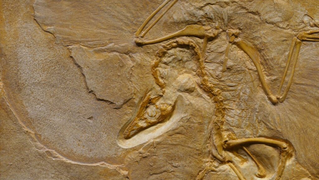
2 - Chavín de Huantar, Peru

In 2012, researchers used drones equipped with a thermal imaging camera to study the underground tunnels and chambers of the Chavín de Huantar temple complex. The thermal images revealed hidden structures and passageways that were not visible to the naked eye.

Chavín de Huantar, Peru

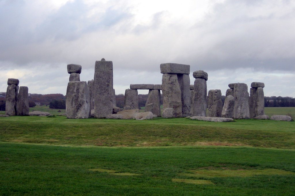
3 - Stonehenge, United Kingdom

In 2013, archaeologists used drones to create a detailed 3D map of the iconic Stonehenge monument. The map revealed new details about the layout and construction of the site, as well as evidence of previously unknown burial mounds.

Stonehenge, United Kingdom

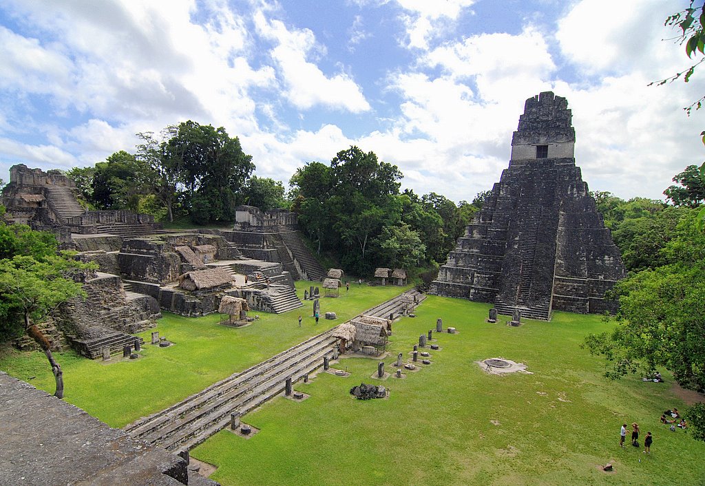
4 - Tikal, Guatemala

In 2018, archaeologists used drones to study the ancient Mayan city of Tikal, which was one of the largest and most important cities in the Mayan civilization. The drones were equipped with lidar sensors, which revealed the city's complex network of roads, canals, and agricultural terraces.
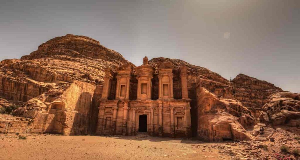
Tikal, Guatemala

5 - Petra, Jordan

In 2016, archaeologists used drones to create a 3D map of the ancient city of Petra, which was carved into the rock by the Nabataean civilization over 2,000 years ago. The map revealed new details about the layout and construction of the city, including a monumental staircase that had been hidden for centuries.

Petra, Jordan

Challenges and Limitations and Ethical Considerations

As shown in the previous sections, the importance of drones to archaeologists is significant; however, there is always the positive and the negative side associated with their use. For instance, they can be affected by weather conditions such as wind and rain, and their battery life is limited, which can restrict the amount of time they can spend in the air.
In addition, regulatory issues need to be taken into account when they are employed for archaeological research. Many countries have strict regulations governing the use of drones, and researchers need to be aware of these regulations and obtain the necessary permits before using them in their work. There are some types of archaeological research- such as ethnographic research, in which ground-based surveys and excavations are more appropriate methods. In these cases, research is conducted on foot to better understand the context and the environment of the culture studied.
The ethical considerations are related to the high historical and cultural significance of the sites. In other words, archaeologists need to ensure that drone technology will not pose a risk of damaging the findings. Lastly, they need to ensure that any data collected using drones is stored securely and used in a responsible and ethical manner.

Takeaway

Drones are changing how archaeologists explore and document ancient sites, offering a range of benefits and opportunities for research. While challenges and limitations are associated with their use, researchers are working to overcome these issues and improve drone technology for archaeological use. By considering the ethical implications of drone use and working collaboratively with local communities, archaeologists can ensure that drones are used responsibly and respectfully, contributing to our understanding of the past and preserving these sites for future generations.
Do you think that drones are a valuable tool for archaeological research, or do they take away from the authenticity of the exploration experience? Leave your thoughts on the comments section below.

Explore

Agriculture

07 Jun 2023

Drones Revolutionize Pest Detection in Agriculture

HEIFU Pro

Hexacopter

VTone

Quadcopter Fixed Wing

beXStream

Remote Control Software

Leave a Comment

More Articles

join the success

Discover our solutions

Scroll to Top